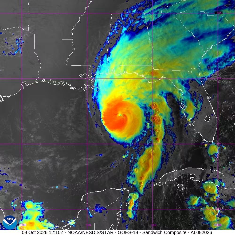
GULF OF MEXICO — Hurricane Isaias has strengthened into the first major hurricane of the year, with the storm threatening the northern US Gulf Coast with dangerous storm surge, heavy rainfall and hurricane-force winds.
At 7 am CDT Friday, Isaias was located about 245 miles south of Pensacola, Florida, and 170 miles south-southeast of the mouth of the Mississippi River. It was moving north-northeast at 15 mph, with a turn towards the north expected later in the day.
The hurricane is forecast to approach the northern Gulf Coast on Friday afternoon and make landfall within the warning area tonight or early Saturday. Maximum sustained winds are near 110 mph, with higher gusts. Hurricane-force winds extend up to 30 miles from the centre, while tropical-storm-force winds reach up to 185 miles.
A hurricane warning is in effect from Ocean Springs, Mississippi, to the Bay and Gulf County line in Florida. A storm surge warning covers the coast from the mouth of the Mississippi River to the Suwannee River in Florida.
Storm surge could raise water levels by six to nine feet above ground between the Alabama-Florida border and Grayton Beach, Florida, if peak surge coincides with high tide. Other areas along the coast could experience water levels rising between two and seven feet.

The surge could flood normally dry coastal areas, with the greatest danger where onshore winds push water inland alongside large and dangerous waves. People in warning areas have been urged to protect life and property and follow evacuation instructions from local officials.
Isaias is also expected to bring four to eight inches of rain through the weekend to southern Alabama, the Florida Panhandle and Big Bend, and southwestern Georgia. Localised totals could reach 15 inches, particularly across parts of the Florida Panhandle and Big Bend.
Across much of the remainder of the southeastern United States, rainfall totals of two to five inches are forecast, with isolated amounts of up to 10 inches possible across the southern Appalachian Mountains and coastal Carolinas.
Flash and urban flooding are likely, while river flooding could be significant in some areas.
A tornado threat is expected to begin late Friday afternoon across coastal Alabama, the Florida Panhandle and far southwestern Georgia, continuing into the night. The risk is forecast to persist on Saturday across parts of eastern Alabama, Florida, Georgia and the Carolinas.
Swells generated by Isaias are also expected to spread towards the Gulf Coast, bringing life-threatening surf and rip current conditions.

Leave a Reply