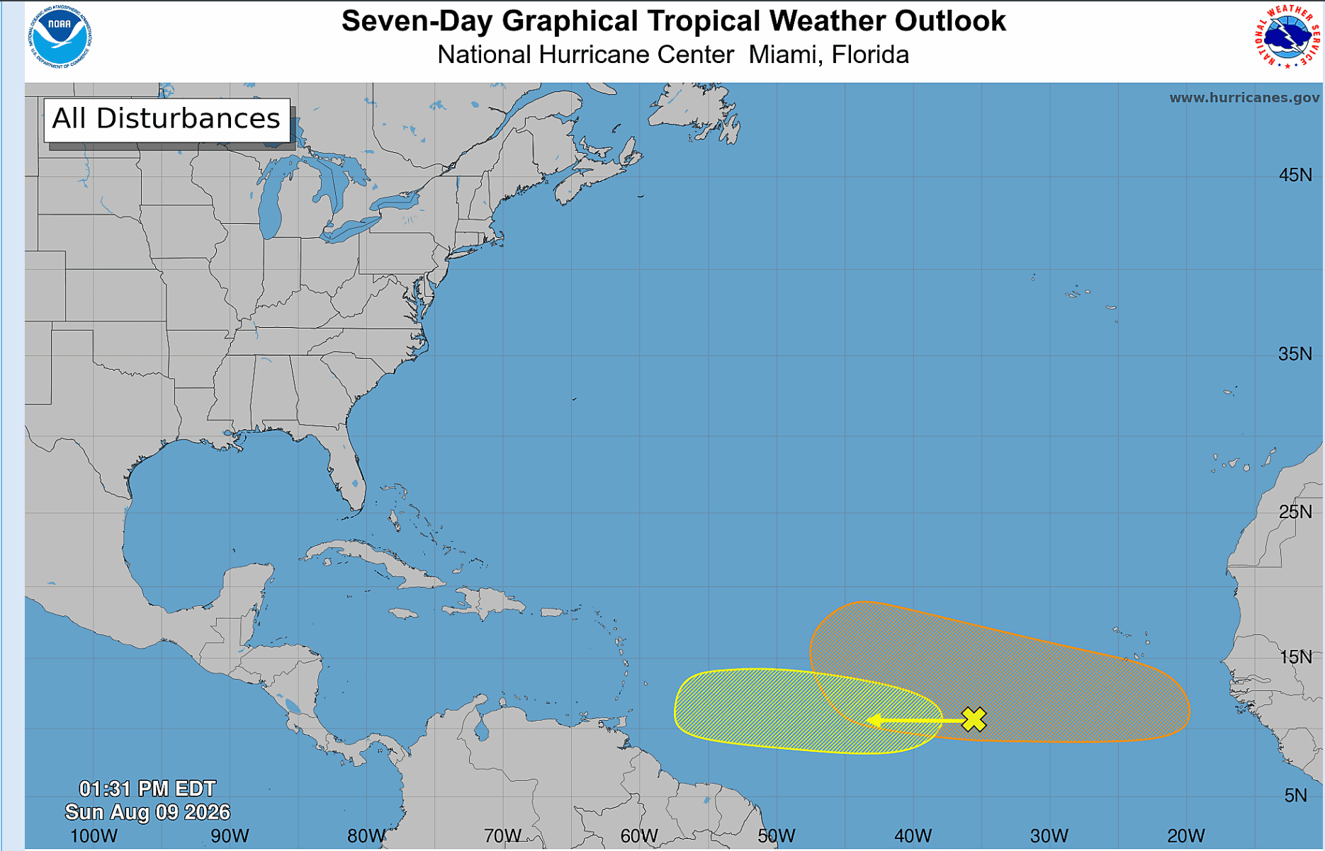
The Atlantic hurricane season could be showing signs of becoming more active as the basin approaches its climatological peak, with two tropical waves now being monitored for possible development.
The US National Hurricane Center (NHC) said the system with the greatest potential is a tropical wave expected to move off the west coast of Africa early this week.
Environmental conditions are forecast to be conducive to gradual development, and a tropical depression could form during the latter half of the week as the system moves westward to west-northwestward across the central tropical Atlantic.
The NHC has given the system a 50 per cent chance of development over the next seven days.
A second area of interest is located several hundred miles west-southwest of the Cabo Verde Islands in the central tropical Atlantic. The broad area of showers and thunderstorms is associated with another tropical wave.
Some gradual development is possible during the early to middle part of this week as the system moves westward across the central tropical Atlantic. However, forecasters expect the system’s chances of developing to decrease later in the week as upper-level winds become less favourable when it approaches the Lesser Antilles.
The second system has a 20 per cent chance of development over the next seven days.
The Atlantic hurricane season reaches its climatological peak around September 10.
The US National Oceanic and Atmospheric Administration (NOAA) continues to forecast a below-normal hurricane season.
In its updated outlook issued on August 6, NOAA maintained its prediction of seven to 13 named storms, including the two tropical storms that have already formed.
Of those, two to six could become hurricanes and zero to two could reach major hurricane strength.
NOAA puts the likelihood of a below-normal season at 75 per cent, compared with a 20 per cent chance of a near-normal season and a five per cent chance of an above-normal season.
A typical Atlantic hurricane season produces 14 named storms, seven hurricanes and three major hurricanes.
NOAA forecasters have attributed the below-normal outlook in part to El Niño conditions, which generally increase wind shear over the Atlantic and can suppress tropical cyclone development.
Leave a Reply