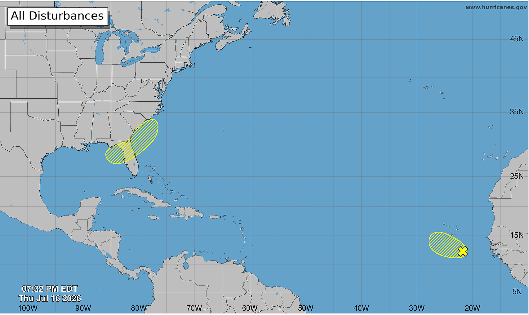
The US National Hurricane Center (NHC) is monitoring two areas for possible tropical development across the Atlantic basin, although both systems are expected to have a low chance of becoming tropical cyclones over the coming days.
The first area is a tropical wave located southeast of the Cape Verde Islands in the eastern Tropical Atlantic.
According to the NHC, showers and thunderstorms associated with the wave remain disorganised, with any development expected to be slow over the next day or two as the system moves generally west-northwest at around 10 mph.
Forecasters said the system is expected to encounter an unfavourable environment by the weekend, making further development unlikely.
The disturbance has a 10 per cent chance of formation over the next 48 hours and a 10 per cent chance over the next seven days.
Meanwhile, forecasters are also watching a second area over the northeastern Gulf of America, where an area of low pressure is expected to develop this weekend.
The NHC said gradual development of the system is possible as it moves slowly northeastward across the northeastern Gulf and near the coast of the southeastern United States early next week.
The system has almost no chance of developing over the next 48 hours but carries a 20 per cent chance of formation over the next seven days.
The 2026 Atlantic hurricane season has remained unusually quiet, with only one named storm forming so far. The lack of activity has largely been attributed to the influence of the El Niño weather pattern, which typically suppresses hurricane development in the Atlantic by increasing wind shear.
To date, the season’s only named storm has been Tropical Storm Arthur, a short-lived and disorganised system that brought flash flooding and tornadoes to parts of the southern United States.
Arthur developed after a tropical wave interacted with the remnants of Tropical Storm Cristina just east of the Yucatán Peninsula. As of June 18, at least four people had been confirmed dead as a result of the storm.

Leave a Reply